|
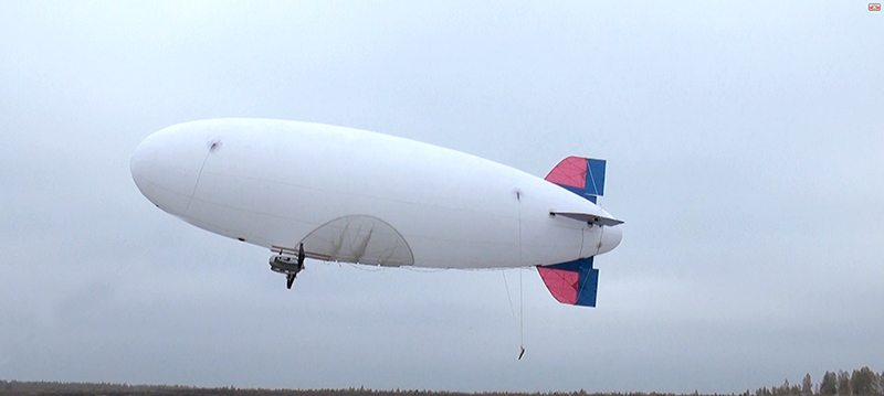
Unmanned aircraft system for ecological terrain monitoring based on airship (EM UAS)
Link to Contact Information (Only For Members of GetOwner Role)
Ref: TO
2426
Submission Date:
15/03/2017
Active before:
31/12/2021
Contact Information
Department:
The Department of Physical-Engineering Sciences
Organization:
The Republican Unitary Enterprise "The Scientific and Production Centre for Multifunctional Unmanned Systems" of the National Academy of Sciences of Belarus
Name:
Maksimava Maryia
Email:
belarus.uav@gmail.com
Telephone:
+375 17 397 00 90
Link to website:
[url]http://uavbusel.by/[/url]
Link to the corresponding profile in Russian
| |

|
Description
EM UAS are used for detailed monitoring of terrain and objects in fully stocked wood through tops of trees, moving objects tracking and also provided with data on-line transmission station which allows transmitting live video feed from EM UAS on the GCS and to other remote users.[br][/br][br][/br]EM UAS with flight range up to 50 km provides detailed monitoring with speed up to 40 km/h in daylight and nightlight hours. The airship is equipped with payload mounted on gyro-stabilized platform (IR-, TV- and photo cameras). Depending on payload UAS can be used for emergency situations detection; oil-and-gas pipelines condition monitoring; land cadaster and mapping solution; state frontier control including fully stocked wood; agricultural lands monitoring; power lines and atmosphere condition monitoring; video films and natural landscapes recording; media placement on the airship's sides.[br][/br][br][/br]System contents:[br][/br]* UAV based on airship;[br][/br]* Backup facilities;[br][/br]* Module of transmitting-receiving equipment;[br][/br]* Standard set of payload mounted on gyro-stabilized platform (TV-, IR-, photo- cameras, multispectral cameras or combine TV- and IR- modules);[br][/br]* GCS;[br][/br]* Set of tool kit.
Technology Type
Design
Technological Keywords
unmanned aerial vehicle, video monitoring, aerial photography, ground control unit, autopilot
Development Stage
Currently in use/production
Other:
Its batch manufacturing and delivery in different modifications was started in 2014.
Intellectual Property Rights
Secret Know-How
Classifier Used at the Enterprise Europe Network
Space and Aerospace
Classifier Used at the Technology Transfer Network of yet2.com Inc.
Aerospace
Environmental
Preferable Regions
North America
South America
Europe
Asia
Africa
Australia
Type of Collaboration Sought
License
For Sale
Available Technical Assistance
Documentation
Personnel
|